info@civilinfrasolution.com737-900-6676 Customer sign in
SAMS Asset Management · Pavement · Work orders · Field data

Every public asset, from field data to funded plan.

CIS collects the data and SAMS Asset Management turns it into decisions. One GIS platform for pavement and asset management, enterprise work orders, and the field and AI tools that keep your inventory current.

ASTM D6433 PCIAWS, Google Cloud or AzureYour data stays yours
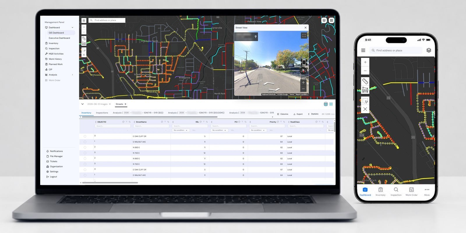
SAMS pavement management software on a laptop and a phone: street network colored by PCI with Google Street View and the streets inventory table
250+agencies served
across 41 states
One platform, three products

Plan it, run it, and keep the data current.

The SAMS products share one map and one database, so they work together from day one. Most agencies start with one and add the others as they grow.

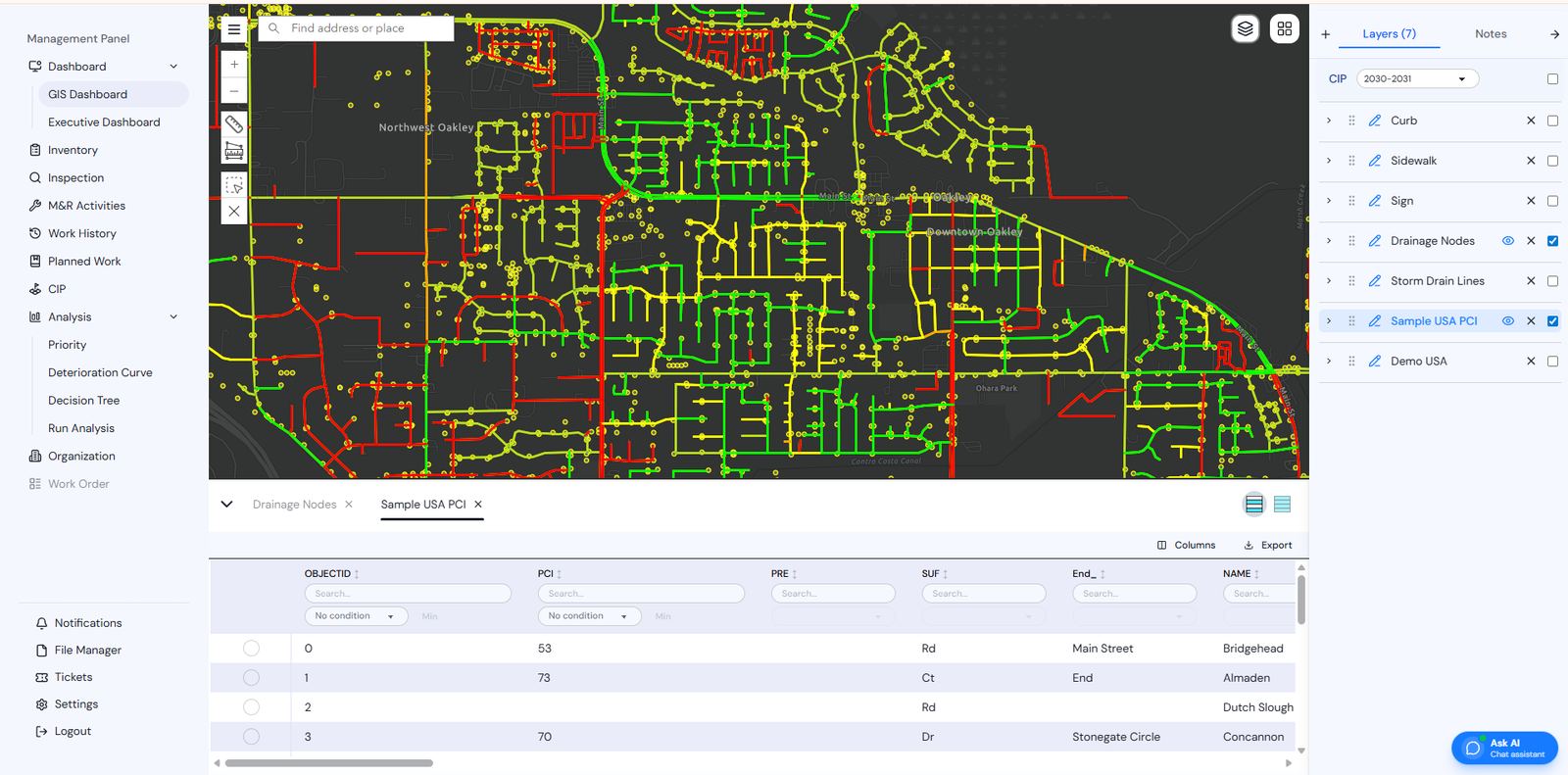
Pavement condition map and segment table in SAMS Core
SAMS Core

Pavement & asset management

  • Automated ASTM D6433 PCI, on a live GIS map
  • Deterioration curves and decision trees you build yourself
  • Multi-year CIP scenarios, optimized for the most network per dollar
  • Council-ready reports and a public dashboard
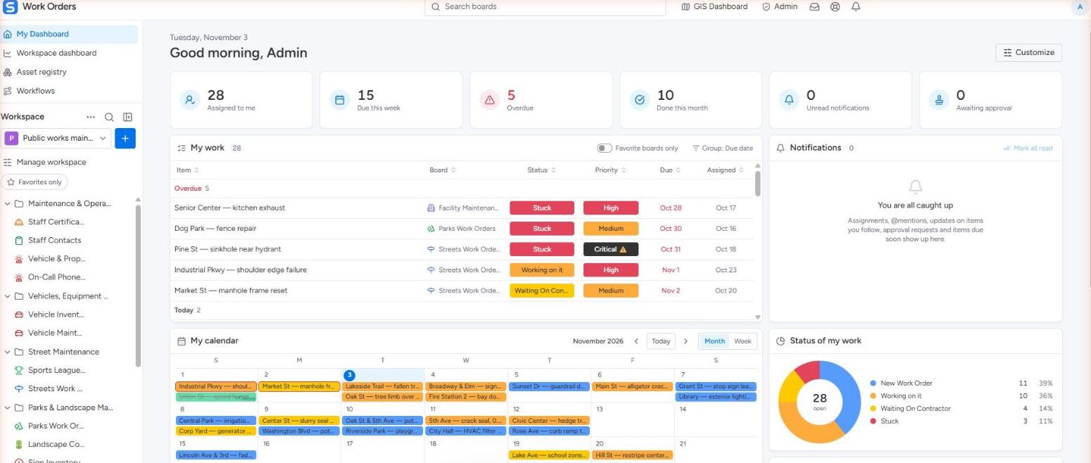
SAMS Work Orders My Dashboard with assigned, due and overdue work
SAMS EAM

Enterprise asset management & work orders

  • Asset registry for roads, parks, fleet, facilities and utilities
  • Work orders from the map, with cost, crew, due date and SLA
  • Approval workflows by priority, cost or emergency
  • Boards, Kanban, calendar and dashboards per department
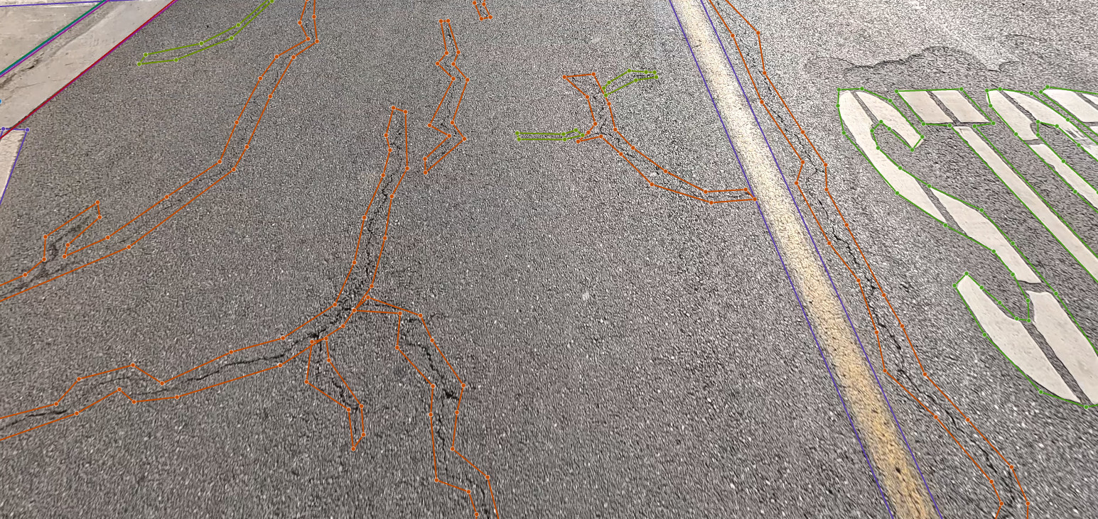
SAMS Studio distress mask over a survey frame
Data collection

Mobile mapping, AI & SAMS Studio

  • 4K and 360° imagery of every lane, at posted speed
  • AI detects distresses, signs, markings and ROW assets
  • SAMS Studio: analysts check every detection before delivery
  • SAMS Collector: field inspections on phone or tablet
A single source of truth

Manage every public asset in one GIS platform.

From the road surface to the water main: configure your own asset types, forms, workflows and dashboards for an agency of any size.

Pavement
Sidewalks
Signals
Parks & recreation
Facilities
Stormwater
Water distribution
Wastewater
Water treatment
Bridges
Tunnels
Bike lanes
Public transit
Power grid
SAMS Core

Model deterioration. Predict the future. Defend the budget.

Build deterioration curves, priority decision trees and rehabilitation trees in a visual editor, then run multi-year analyses with budgets, inflation and carryover. The optimizer weighs every treatment option and picks the mix with the highest return within your budget.

  • Bulk multi-year analyses with minimum and maximum budgets
  • Inflation, carryover, planned and historic work
  • Filter segments by any inventory or inspection attribute
  • Ask the built-in AI: "What is the projected PCI of Rose Ave in 2030?"
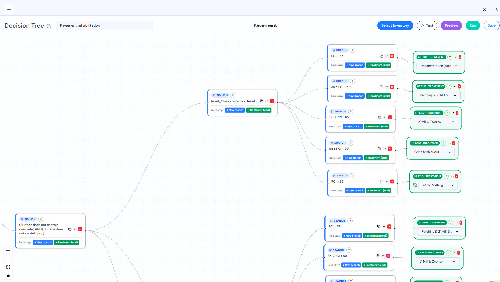
SAMS decision tree editor: arterial streets branch by PCI band to reconstruction, mill and overlay, cape seal or do nothing
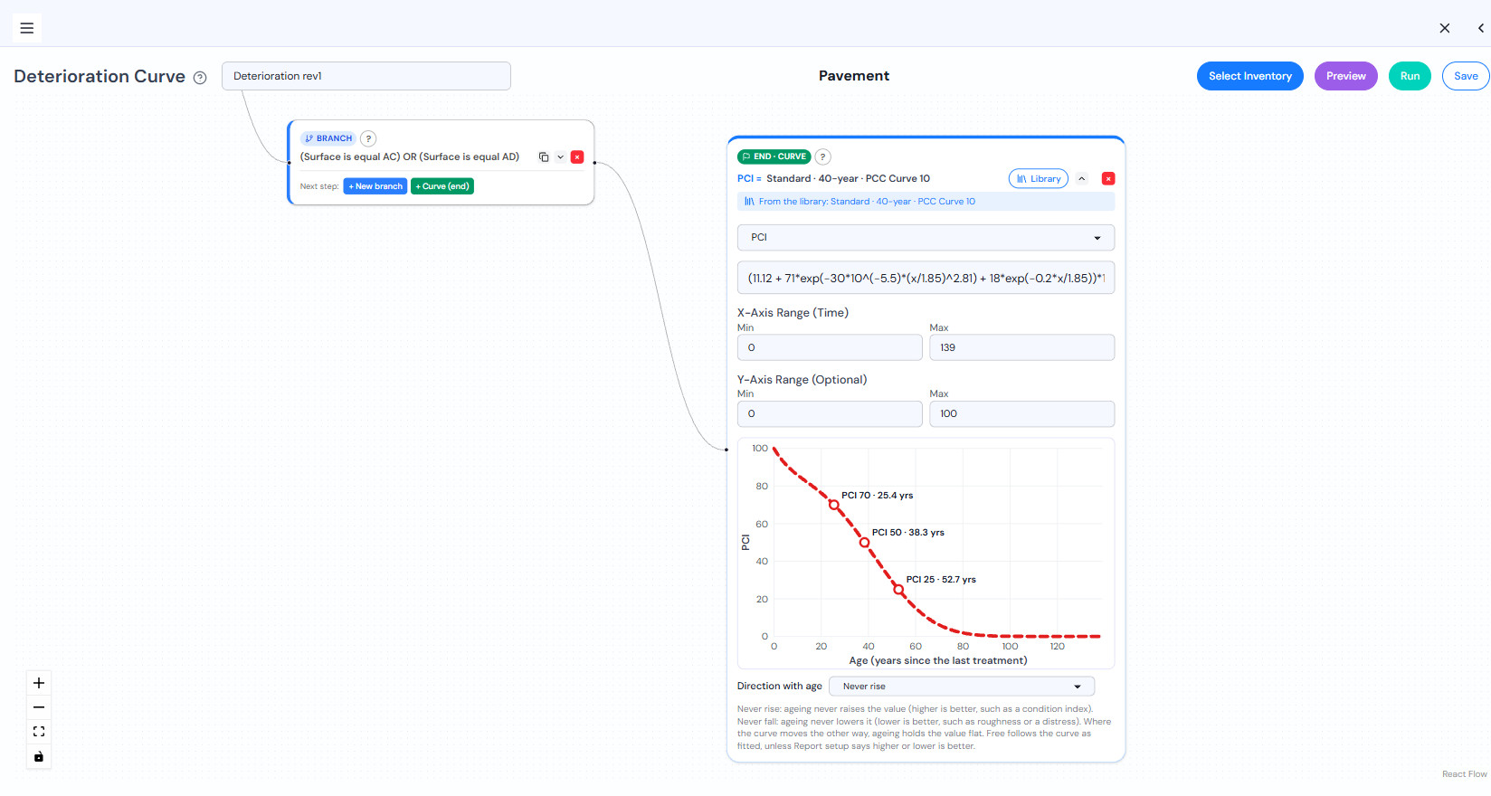
SAMS deterioration curve editor for asphalt, with PCI 70 at 25.4 years, 50 at 38.3 and 25 at 52.7
Try it

Age a street and watch SAMS pick the treatment.

This is a real SAMS decision tree and deterioration curve, running in your browser. Choose the surface and road class, drag the age, and the curve predicts the PCI while the tree follows the same branches SAMS does to a treatment and its unit cost.

Surface
Road class

1 · Deterioration curve

70Fairpredicted PCI

2 · Decision tree

Built from a real SAMS decision tree and deterioration curve, with each treatment's unit cost.Drag the age or pick a road to follow the branches.
SAMS EAM · Work orders

From a field issue to finished, documented work.

A fallen tree, a pothole, a knocked-down stop sign: each one becomes a costed, assigned work order linked to the asset on the map. Managers see what is moving, what is waiting on a contractor and what is overdue.

  • Create work orders from the GIS map, with asset context
  • Routing by priority, cost or emergency, with SLA timers
  • Close-out checklists, photos and a locked history
  • Works offline in the field and syncs when back online
SAMS Work Orders · My Dashboard
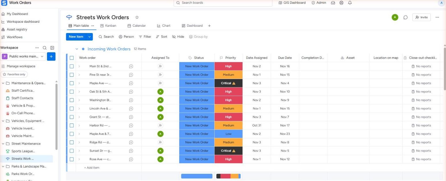
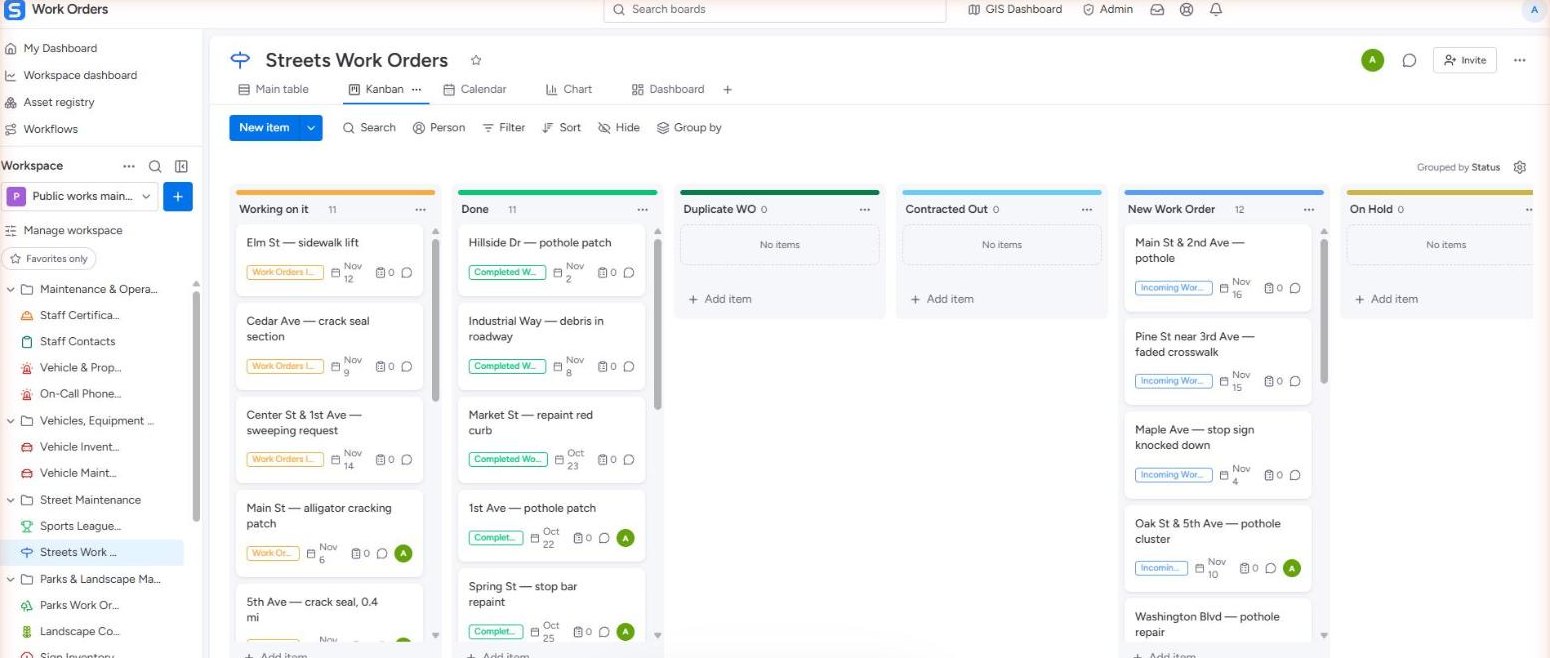
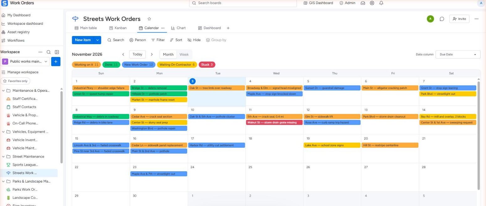
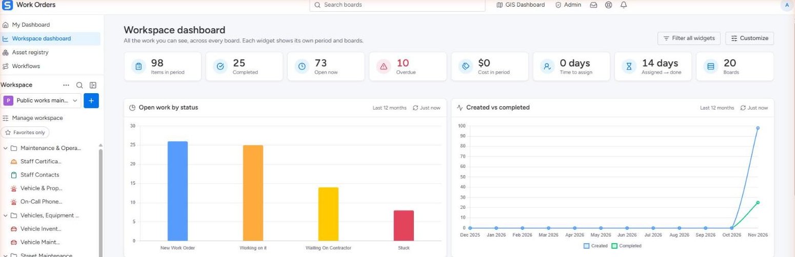
My Dashboard: 28 assigned to me, 15 due this week, 5 overdue, with my work list, calendar and status chart Streets Work Orders board, main table grouped by incoming, in progress and waiting on contractor Streets Work Orders in Kanban view, cards grouped by status Streets Work Orders calendar for November with work orders on their due dates Workspace dashboard: items, completed, open, overdue, open work by status and created vs completed
Data collection · SAMS Studio

Objective condition data, checked by engineers.

Our collection vehicles image every lane at posted speed, with no lane closures. AI detects and measures distresses and roadside assets; in SAMS Studio our analysts review the detections and sign off before anything reaches your GIS.

  • Pavement PCI to ASTM D6433, or your agency's protocol
  • Sidewalks, curb ramps and ADA transition plans
  • Signs, markings, guardrails, poles and streetlights
  • FWD structural testing and airfield PCI
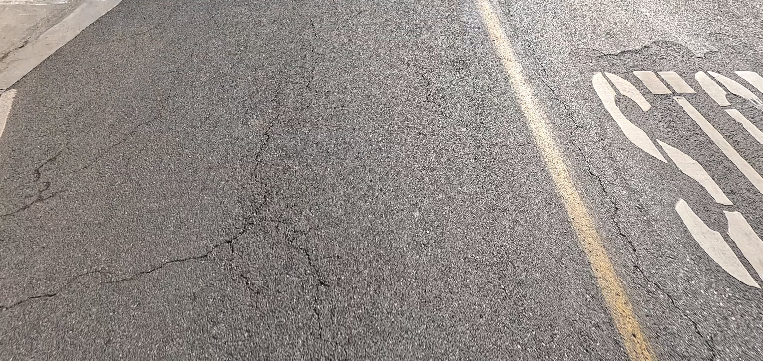
Survey frame of a residential street with cracking, as captured The same frame in SAMS Studio with every crack, the asphalt area and the pavement markings outlined Survey frameSAMS Studio · distress mask
Real SAMS Studio screens: one 4K survey frame with the distress mask off and on. Drag to compare.
Why pavement management pays

Preserve roads while they are still good.

Timely preservation costs a fraction of reconstruction. Objective data shows where each dollar does the most.

$4–$10saved in future rehabilitation for every $1 of timely preventive maintenance
5–15 yrsof extra pavement life from treatments applied at the right time
10–100×what full-depth reconstruction can cost compared with preservation
95%of SAMS agencies re-run their CIP every fiscal year
How we work

From your goals to a plan your council can approve.

Define goals & needs

Map asset classes, data sources and stakeholders, and agree what success looks like this fiscal year.

Collect or import data

We survey your network, or you upload GeoJSON, Excel or CSV. The import wizard maps and checks the columns.

Model & prioritize

Deterioration curves, decision trees and ranking models in a visual editor.

Run scenarios

Compare funding levels, inflation and constraints. See the gaps and long-term trade-offs.

Publish results

Council-ready reports, interactive dashboards and a public page for residents.

Experience

Trusted by agencies coast to coast.

Cities, counties, regional agencies, state DOTs, airports and military installations whose pavement and right-of-way programs the CIS team has delivered.

250+agencies served
41states, plus 6 other countries
62military installations
25+years of PAVER and PCI experience

Hover or tap a circle to see the agencies in that area.

Council-ready reports

A complete pavement management plan, written from your data.

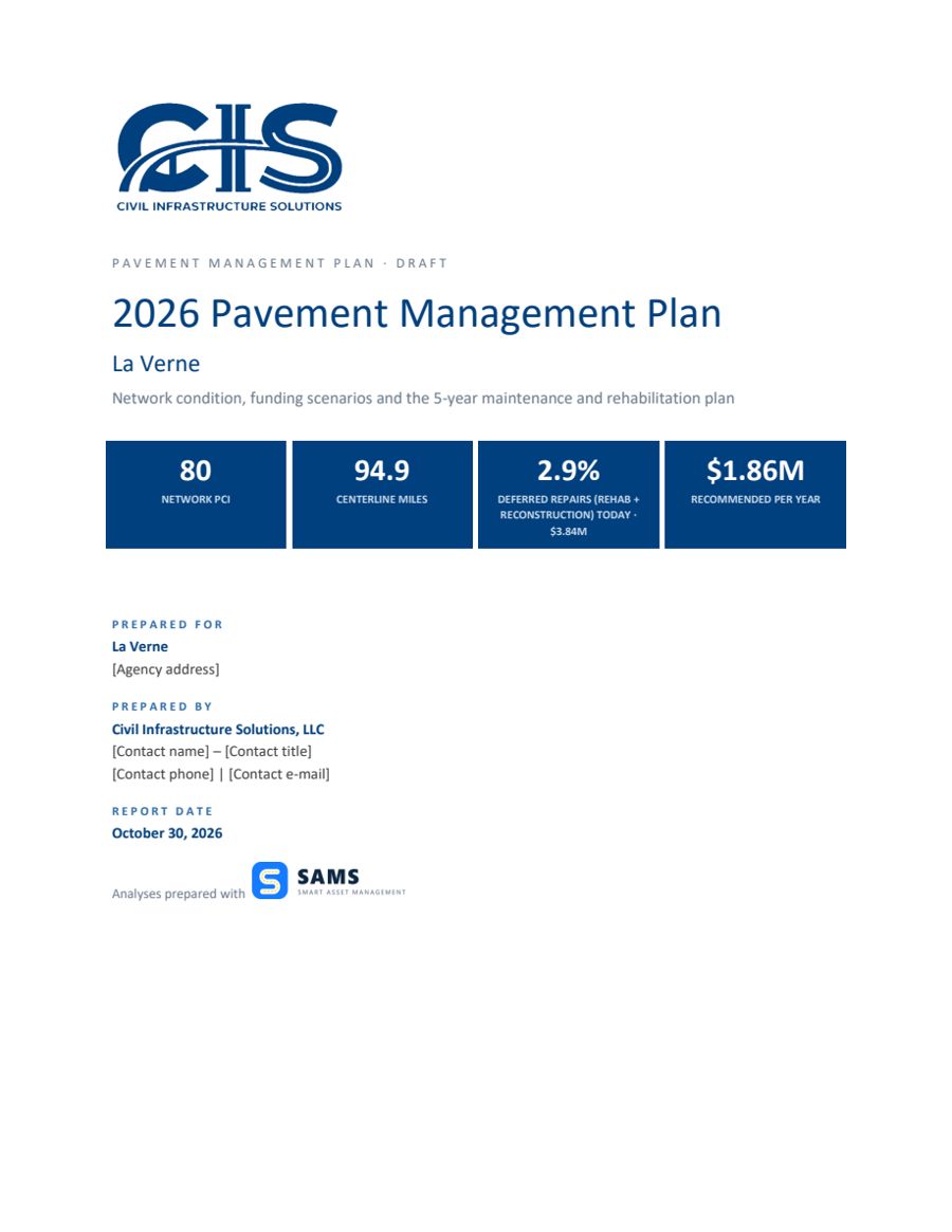
Executive summary, metrics of network health, budget scenarios, the recommended five-year plan, maps and street-by-street tables, in Word and PDF with your logo.

Report cover with key network metricsExecutive summary pageBudget scenario chart page
What engineers say

Built with the people who use it.

We have used SAMS on several projects, and I honestly couldn't be happier with the results. The platform combines a remarkably user-friendly interface with powerful analytical capabilities that make complex pavement and asset management tasks significantly easier and more efficient.
Hamed MajidfardCEO, TEE
I've spent over 25 years helping public agencies implement pavement and enterprise asset management systems across the country. SAMS stands apart. Its flexibility, modern design, and ease of use are unmatched, giving agencies the power to manage their assets the way they want.
Kurt Keifer, PhD, PEPresident, CIS
Questions

Briefly answered.

How fast can we get SAMS up and running?

Upload your shapefile and start planning in minutes. For larger programs we offer a guided pilot for qualified agencies.

Can SAMS plan for all of our assets, not only pavement?

Yes. Pavement, sidewalks, ADA curb ramps, signs, pavement markings and other assets are managed in one integrated platform, with multi-year plans for each.

How does SAMS get the most out of our budget?

The optimization engine evaluates the treatment options for every segment and selects the combination that delivers the highest return within your budget and your agency's priorities.

Where is our data hosted, and who owns it?

Your data is yours, and you control where it is stored. SAMS can be deployed in the cloud of your choice, including AWS, Google Cloud and Microsoft Azure.

Do we need ArcGIS Online?

No. SAMS works with your existing GIS data: GeoJSON, shapefiles, Excel and CSV. We help map the columns during import.

See SAMS with your own data.

A 20-minute demo is enough to see the multi-year picture. We reply within one business day.